PaperArticles in SCI Journals
1. Jun Yan; Yiming Cao; Bin Kang; Xiaohuan Wu; Liang Chen. An ELM-Based Semi-Supervised Indoor Localization Technique With Clustering Analysis and Feature Extraction. IEEE Sensors Journal ( IF 3.073 ) .2020,10(5) , DOI: 10.1109/jsen.2020.3028579
2. Yue Yu, Ruizhi Chen*, Liang Chen, Wei Li, Yuan Wu, Haitao Zhou. Precise 3D Indoor Localization Based on Wi-Fi FTM and Built-in Sensors. IEEE Journal of Internet of Things
3. Nan Shen, Liang Chen*, Lei Wang, Xiangchen Lu, Tingye Tao, Jun Yan, and Ruizhi Chen. Site-Specific Real-time GNSS Multipath Mitigation Based on Coordinate Time Series Window Matching. GPS Solutions,24,82 (2020) DOI:10.1007/s10291-020-00994-z(二区)
4. X. Zhou, L. Chen, J. Yan and R. Chen, "Accurate DOA Estimation With Adjacent Angle Power Difference for Indoor Localization," IEEE Access, vol. 8, pp. 44702-44713, 2020(二区)
5. Yue Yu, Ruizhi Chen*, Liang Chen, Wei Li, Yuan Wu, Haitao Zhou.Precise 3D Indoor Localization Based on Wi-Fi FTM and Built-in Sensors,IEEE Internet of Things Journal[J]. IEEE Internet of Things Journal, 2020, PP(99):1-1. (一区)
6. Yuanjin Pan, Ruizhi Chen, Shuang Yi, Wei Wang, Hao Ding, Wenbin Shen, Liang Chen. Contemporary Mountain‐Building of the Tianshan and its Relevance to Geodynamics Constrained by Integrating GPS and GRACE Measurements. Journal of Geophysical Research: Solid Earth, 2019, 124(11).
7. Zhipeng Cao, Yifan Cheng, Ruizhi Chen, Guangyi Guo, Feng Ye, Liang Chen & Yuanjin Pan (2019) An infant monitoring system with the support of accurate real-time indoor positioning, Geo-spatial Information Science, 22:4, 279-289, DOI: 10.1080/10095020.2019.1631617
8. Shen N, Chen, L.* Liu J, Wang L, Tao T, Wu D, Chen R. A Review of Global Navigation Satellite System (GNSS)-Based Dynamic Monitoring Technologies for Structural Health Monitoring. Remote Sensing. 2019; 11(9):1001.
9. Yue Yu, Ruizhi Chen*, Liang Chen, Guangyi Guo, Feng Ye and Zuoya Liu. A Robust Dead Reckoning Algorithm Based on Wi-Fi FTM and Multiple Sensors. Remote Sens. 2019, 11(5), 504-526; doi:10.3390/rs11050504.
10. Yan, J.; Zhu, B.; Chen, L.*; Wang, J.; Liu, J. Error Analysis on Indoor Localization with Visible Light Communication. Remote Sensing, 2019,11 (4), 427-444. doi:10.3390/rs11040427
11. Guo, G.; Chen, R.; Ye, F.; Chen, L.; Pan, Y.; Liu, M.; Cao, Z. A Pose Awareness Solution for Estimating Pedestrian Walking Speed. Remote Sens. 2019, 11, 5. doi:10.3390/rs11010055
12. Liang Chen*, Olivier Julien, Elena-Simona Lohan, Gonzalo Seco-Granados, and Ruizhi Chen. Mobile Geospatial Computing Systems for UbiquitousPositioning. Mobile Information Systems
Volume 2018, Article ID 9138095,pp. 1-2, 2018
13. Jun Yan, Lin Zhao, Jian Tang, Yuwei Chen, Ruizhi Chen, Liang Chen*. Hybrid Kernel Based Machine Learning Using Received Signal Strength Measurements for Indoor Localization. IEEE Transactions on Vehicular Technology, 2018, 67(3): 2824 – 2829, DOI: 10.1109/TVT.2017.2774103
14. Xinlian Liang, Juha Hyyppa, Harri Kaartinen, Liang Chen etal. International benchmarking of terrestrial laser scanning approaches for forest inventories, ISPRS Journal of Photogrammetry and Remote Sensing, vol. 144, October 2018, pp. 137-179. DOI: 10.1016/j.isprsjprs.2018.06.021
15. Dewen Wu, Ruizhi Chen*, Liang Chen. Visual Positioning Indoors: Human Eyes vs. Smartphone Cameras, MDPI Sensors,2017, 17 (11), 2645
16. Liang Chen*, Lie-Liang Yang, Jun Yan, Ruizhi Chen. Joint Wireless Positioning and Emitter Identification in DVB-T Single Frequency Networks. IEEE Transactions on Broadcasting, 2017, vol. 63, no. 3, pp. 577-582, 2017.
17. Jun Yan, Kegen Yu, Yangqin Cao, Liang Chen*. Attack-Resistant Received Signal Strength based Compressive Sensing Wireless Localization. KSII Transactions on Internet and Information Systems, 2017, vol. 11, no. 9, pp. 4418-4437.
18. Liang Chen*, Sarang Thombre, Kimmo Jarvinen, Elena Simona Lohan, Anette Alen-Savikko, Helena Leppakoski, M. Zahidul H. Bhuiyan, Shakila Bu-Pasha, Giorgia Nunzia Ferrara, Salomon Honkala, Jenna Lindqvist, Laura Ruotsalainen, Paivi Korpisaari and Heidi Kuusniemi. Robustness, Security and Privacy in Location-Based Services for Future IoT: A Survey. IEEE Access, 2017, vol. 5, Issue 1, pp. 8956-8977, 2017. (SCI)
19. Jun Yan, Kegen Yu, Ruizhi Chen, Liang Chen*. An improved Compressive Sensing and Received Signal Strength-based Target Localization Algorithm with Unknown Target Population for Wireless Area Networks, Sensors, 2017, vol. 17,no. 6, pp. 1246-1263. doi: 10.3390/s17061246 (SCI EI)
20. Liang Chen*, Paul Thevenon, Gonzalo Seco-Granados, Olivier Julien and Heidi Kuusniemi. Analysis on TOA Tracking with DVB-T Signals for Positioning. IEEE Trans. on Broadcasting. 2016, vol. 62, no. 4, pp. 957-961(SCI, EI)
21. Liang Chen*, Olivier Julien, Paul Thevenon, Damien Serant and Heidi Kuusniemi. TOA Estimation for Positioning with DVB-T Signals in Outdoor Static Tests. IEEE Transactions on Broadcasting, 2015, vol. 61, no. 4, pp. 33-38. (SCI:CY8NU, EI:20153901302080)
22. Liang Chen, Robert Piche, Heidi Kuusniemi and Ruizhi Chen. Adaptive Mobile Tracking in Unknown Non-line-of-sight Conditions with Application to Digital TV Networks. EURASIP Journal on Advances in Signal Processing, 2014:22 doi:10.1186/1687-6180-2014-22. (SCI: AF0PD,EI: 20141817684286)
23. Liang Chen, Ling Pei, Chen, Heidi Kuusniemi, Yuwei Chen, Tuomo Kröger and Ruizhi Chen. Bayesian Fusion for Indoor Positioning Using Bluetooth Fingerprints. Wireless Personal Communications, 2013, vol. 70, no. 4, pp. 1735—1745. (SCI:165EC, EI:20132416411147)
24. Liang Chen, Simo Ali-Löytty, Robert Piche and Wu Lenan.Mobile tracking in mixed line-of-sight/non-line-of-sight conditions: algorithm and theoretical lower bound, Wireless Personal Communications, vol. 65, no. 4, pp. 753-771, 2012. (SCI:969rn, EI:20123215327708)
25. Liang Chen and Wu Lenan. Mobile positioning in mixed LOS/NLOS conditions using modified EKF banks and data fusion method, IEICE Transactions on Communications, vol. E92-B, no. 4, pp. 1318-1325, 2009. (SCI: 440LN ,EI: 20103813241320)
26. Liang Chen, Jin Le, Wu Lenan, Hanwen Chen. Dynamic network selection for multicast services in wireless cooperative networks, IEICE Transactions on Communications, vol. E91-B, no. 10, pp. 3069-3076, 2008. (SCI:365IU, EI:20093112226875)
27. Qian, Chuang, Hui Liu, Jian Tang, Yuwei Chen, Harri Kaartinen, Antero Kukko, Lingli Zhu, Xinlian Liang, Liang Chen, and Juha Hyyppä. An Integrated GNSS/INS/LiDAR-SLAM Positioning Method for Highly Accurate Forest Stem Mapping. Remote Sensing, no. 1 (2016): 3. (SCI EI)
28. Sarang Thombre, Heidi Kuusniemi, Stefan Söderholm, Liang Chen, Robert Guinness, Zbigniew Pietrzykowski, Piotr Wołejsza. Operational Scenarios for Maritime Safety in the Baltic Sea, Navigation, 2016, vol. 63, no. 4, pp. 521-531, DOI: 10.1002/navi.161 (SCI)
29. Wuyang Jiang, Ling Pei, Changqing Xu, Liang Chen and Wenxian Yu. Two-stage Localisation Scheme Using a Small-scale Linear Microphone Array for Indoor Environments. Journal of Navigation, 2015, vol. 68, no. 5, pp. 915-936. (SCI:CN6XN)
30. Jian Tang, Yuwei Chen, Liang Chen, Jingbin Liu, Juha Hyyppä, Antero Kukko, Harri Kaartinen, Hannu Hyyppä and Ruizhi Chen. Fast SOP Fingerprint Database Maintenance for Indoor Positioning Based on UGV SLAM. Sensors, 2015, vol.15,pp.5311-5330. (SCI:CH6QK, EI:20151800813692)
31. Jian Tang; Yuwei Chen; Xiaoji Niu, Li Wang, Liang Chen; Jingbin Liu; Chuang Shi, Juha Hyyppä. LiDAR Scan Matching Aided Inertial Navigation System in GNSS-Denied Environments. Sensors, 2015, vol. 15, Pages 16710-16728. (SCI:CS0YN, EI: 20153501212615)
32. Laura Ruotsalainen, Heidi Kuusniemi, Zahidul H. Bhuiyan, Liang Chen and Ruzhi Chen. A Two-dimensional Pedestrian Navigation Solution Aided with a Visual Gyroscope and a Visual Odometer, GPS Solutions, vol. 17, no. 4, pp. 575-586, 2013. (SCI:215YI, EI:20133816757727)
33. Heidi Kuusniemi, Liu Jingbin, Pei Ling, Chen Yuwei, Liang Chen and Chen Ruizhi. Reliability considerations of multi-sensor multi-network pedestrian navigation. IET Radar, Sonar & Navigation, vol. 6, no. 3, pp. 157-164, 2012. (SCI:899VA, EI:20121014833980)
34. Ling Pei, Robert Guinness, Ruizhi Chen, Jingbin Liu, Heidi Kuusniemi, Yuwei Chen, Liang Chen and Jyrki Kaistinen. Human Behaviour Cognition Using Smartphone, Sensors, vol. 13, no. 2, pp. 1402-1424, 2013. (SCI:096KS, EI:20131816281748)
35. Liu Jingbin, Ruizhi Chen, Pei Ling, Chen Yuwei and Liang Chen. iParking: An Intelligent Indoor Location-Based Smartphone Parking Service, Sensors, vol. 12, no. 11, pp. 14612-14629, 2012, doi:10.3390/s121114612. (SCI:041VO, EI:20131816281409)
PaperArticles in Peer reviewed Journals
1. 陈锐志,陈亮*. 基于智能手机的室内定位技术的发展现状和挑战, 测绘学报, 46(10):1316-1326. DOI: 10.11947, 2017 (领跑者5000 优秀论文提名)
2. Ling Pei, Jingbin Liu, Yuwei Chen, Ruizhi Chen and Liang Chen. Evaluation of fingerprinting-based WiFi indoor localization coexisted with Bluetooth. The Journal of Global Positioning Systems. December 2017, DOI: 10.1186/s41445-017-0008-x
3. Liang Chen, Heidi Kuusniemi, Chen Yuwei, Pei Ling, Tuomo Kröger and Chen Ruizhi. Motion Restricted Information Filter for Indoor Bluetooth Positioning. International Journal on Embedded and Real-Time Communication Systems, vol 3, no. 3, pp. 54-66, 2012.
4. Laura Ruotsalainen, Liang Chen, Martti Kirkko-Jaakkola, Simo Gröhn and Heidi Kuusniemi. INTACT- Towards infrastructure-free tactical situational awareness. European Journal of Navigation, 2016, vol. 14, no. 4, pp. 33-38. ISSN 1571-473-X
5. Sarang Thombre, Robert Guineness, Liang Chen and Heidi Kuusniemi, et al. ESABALT Improvement of Situational Awareness in the Baltic with the Use of Crowdsourcing. The International Journal on Marine Navigation and Safety of Sea Transportation, 2015, vol. 9, no. 2, pp. 183-189.
6. Zahidul H. Bhuiyan, Heidi Kuusniemi, Liang Chen, Ling Pei, Laura Ruotsalainen and Ruzhi Chen. Performance Evaluation of Multisensor Fusion Models in Indoor Navigation, Journal of European Navigation, vol. 11, no. 2, pp. 20-28, 2013.
7. Liang Chen, Cheng Han wen and Wu Lenan. Modulation classification of MPSK signals based on nonparametric Bayesian inference, Journal of Southeast University (English Version), vol. 25, no. 2, pp. 171-174, 2009. (EI: 20093212240947)
8. 陈亮,何峰,冯熳,吴乐南. 基于粒子滤波的数字广播无线定位与跟踪[J]. 《信号处理》, 2009,25(4)
9. Zhaoliang Liu, Liang Chen*, Nan Shen and Ruizhi Chen. Feasibility Study of Indoor Positioning with LTE Signals. Geo-spatial Information Science (入选国内高水平期刊, major revision)
PaperIn Press
1. Xiangchen Lu, Liang Chen*, Nan Shen, Lei Wang, Zhenhang Jiao, and Ruizhi Chen. Decoding PPP Corrections from BDS B2b Signals Using a Software-defined Receiver: an Initial Performance Evaluation.Submitted to IEEE Sensors Journal (Accepted)
2. YuAn Wang, Liang Chen *, Peng Wei, XiangChen Lu,Visual-Inertial Odometry of Smartphone under Manhattan World,MDPI Remote Sensing, (Accepted)
3. Yankun Wang, Renzhong Guo, Weixi Wang, You Li, Shengjun Tang, wei zhang, Xiaoming Li *, Liang Chen, Luyao Wang, Wenqun Xiu, Near Relation-Based Indoor Positioning Method Under Sparse Wi-Fi Fingerprints ISPRS International Journal of Geo-Information (Accepted)
4. Jun Yan, ...Liang Chen, Extremely Machine Learning, .IEEE Sensors Journal (Accepted)
5. Yu, Y;Chen, RZ*;Liu,ZY;Guo,GY;Ye, F;Chen,L.Wi-FiFine Time Measurement: Data Analysis and Processing for Indoor Localisation. The Journal of Navigation,2020.1-23. (Accepted)
Book Chapter
1. Liang Chen, Heidi Kuusniemi, Yuwei Chen, Ling Pei, Jingbin Liu, Jian Tang, Laura Ruotsalainen, Ruizhi Chen. Information Filter Assisted Indoor Bluetooth Positioning, in Advancing Embedded Systems and Real-Time Communications with Emerging Technologies, Seppo Virtanen eds. IGI Global Press, 2014. DOI: 10.4018/978-1-4666-6034-2
2. Liang Chen, Simo-Ali-Löytty, Robert Piche, and Wu Lenan. Mobile tracking in mixed line-of-sight/non-line-of-sight conditions: algorithms and theoretical lower bound, in Position Location-Theory, Practice and Advances: A Handbook for Engineers and Academics, S. Zekavat and M. Buehrer, eds. Wiley-IEEE Press, Oct. 2011, ISBN: 978-0-470-94342-7.
3. Heidi Kuusniemi, Chen Yuwei and Liang Chen. Multi-sensor Multi-network Positioning, in Ubiquitous positioning and mobile location-based services in smart phones, Ruizhi Chen eds. IGI Global Press, June, 2012, ISBN: 978-146-661827-5.
4. Elena Simona Lohan, Anette Alén-Savikko, Liang Chen, Kimmo Järvinen, Helena Leppäkoski, Heidi Kuusniemi, Päivi Korpisaari. 5G positioning: security and privacy aspects, pp. 281-320, DOI: 10.1002/9781119293071.ch13 in A Comprehensive Guide to 5G Security, Madhusanka Liyanage, Ijaz Ahmad, Ahmed Bux Abro and Mika Ylianttila Eds. John Wiley & Sons. ISBN 9781119293040
专著
陈亮,基于OFDM数字广播信号的无线定位关键技术研究,Golden Light Academic Publishing, 2016 , ISBN: 978-3-639-82525-1,ISBN: 978-3-639-82525-1
Articles in Conference Proceedings
1. Lei Wang, Ruizhi Chen, Liang Chen, Lili Shen, Peng Zhang, Yuanjin Pan and Ming Li* A Robust Filter for TOA Based Indoor Localization in Mixed LOS/NLOS Environment. International Conference on Ubiquitous Positioning, Indoor Navigation and Location-Based Service (UPINLBS 2018), March 22-23, Wuhan, China. DOI:10.1109/UPINLBS.2018.8559862.
2. Ming Li, Ruizhi Chen, Xuan Liao, Bingxuan Guo, Liang Chen, Jinbing Liu, Teng Wu, Lei Wang, Yuanjin Pan and Peng Zhang* A Real-time Indoor Visual Localization and Navigation Method Based on Tango Smartphone.
International Conference on Ubiquitous Positioning, Indoor Navigation and Location-Based Service (UPINLBS 2018), March 22-23, DOI:10.1109/UPINLBS.2018.8559720.
3. Pei Yu, Xiaoyu Zhang, Liang Chen* and Ruizhi Chen. A comparative study on range-based localization algorithms under 5G communication system, in the Second LIESMARS International Graduate Workshop on Geo-Informatics, July 9-11, Wuhan, China (第二届地球空间信息科学博士生国际学术论坛优秀报告奖)
4. Laura Ruotsalainen, Robert Guinness, Simo Gröhn, Liang Chen, Martti Kirkko-Jaakkola and Heidi Kuusniemi. Situational Awareness for Tactical Applications. Proceedings of the 29th International Technical Meeting of The Satellite Division of the Institute of Navigation (ION GNSS+ 2016), Portland, Oregon, September 2016, pp. 1190-1198.
5. Heidi Kuusniemi, Elina-Simona Lohan, Kimmo Järvinen, Paive Korpisaari, Sarang Thombre, Mohammad Zahidul Hasan Bhuiyan, Helen Leppäkoski, Liang Chen, Shakila Bu-Pasha, Anette Alen-Savikko, Jenna Mäkinen, Laura Ruotsalainen, Stefan Söderholm, Robert Guinness, Giorgia N. Ferrara and Salomon Honkala. Information Security Of Location Estimation – Increasing Trustworthiness. Proc. of the ESA Navitec 2016, Noordwijk, NL, Dec. 2016.
6. Jun Yan, Yongxiang He, Bingcheng Zhu and and Liang Chen, Mobile Device Orientation Estimation Using Visible Light Communication System, Proceedings of European Navigation Conference 2016 (ENC 2016), 30 May-2 June, Helsinki, Finland.
7. Laura Ruotsalainen, Martti Kirkko-Jaakkola, Liang Chen, Simo Gröhn, Robert Guinness, Heidi Kuusniemi, Multi-Sensor SLAM for Tactical Situational Awareness, Proceedings of International Technical Meeting - The Institute of Navigation (ION ITM 2016), January 28, 2016, California, United States, pp. 273-282.
8. Liang Chen, Heidi Kuusniemi, Yuwei Chen, Jingbin Liu, Pei Ling and Ruizhi Chen. Constraint Kalman Filter for Indoor Bluetooth Localization. Proceedings of European Signal Processing Conference (Eusipco 2015), Aug. 30- Sep. 4, 2015, Nice, France. ( EI:20161702298645)
9. Heidi Kuusniemi, Sarang Thombre, Stefan Söderholm, Liang Chen, Robert Guinness, Zbigniew Pietrzykowski and Piotr Wolejsza. Operational Scenarios for Maritime Safety in the Baltic Sea. Proceedings of the 28th International Technical Meeting of the ION Satellite Division (ION GNSS + 2015), Sept.14-18, 2015, Tampa, U.S. pp. 944 - 952 (EI:20162602541088, 获最佳论文陈述奖)
10. Laura Ruotsalainen, Simo Gröhn, Martti Kirkko-Jaakkola, Liang Chen, Robert Guinness, Heidi Kuusniemi. Monocular visual SLAM for tactical situational awareness, Proceedings of International Conference on Indoor Positioning and Indoor Navigation (IPIN 2015), Oct 13 -16, 2015, Banff, Canada. (EI: 20161002065365)
11. Olli Nevalainen, Thombre Sarang, Sanna Kaasalainen, Liang Chen, et al, Feasibility of Sentinel-1 data for Enhanced Maritime Safety and Situational Awareness, Proceedings of European Navigation Conference (ENC 2015), April 7 -10, 2015, Bordeaux, France (获最佳学生论文奖)
12. Jingbin Liu, Liang Chen, Ruizhi Chen. HMM-based Pedestrian Location and Motion Joint Estimation toward a Smartphone Geo-context Computing Solution. International Conference on Ubiquitous Positioning, Indoor Navigation and Location-Based Service (UPINLBS 2014), Nov. 20-21, Corpus Christi, Texas, USA.
13. Ruizhi Chen, Tianxing Chu, Jingbin Liu, Yuwei Chen, Liang Chen and Juha Hyyppa : Development of a Contextual Thinking Engine in Mobile Devices. International Conference on Ubiquitous Positioning, Indoor Navigation and Location-Based Service (UPINLBS 2014), Nov. 20-21, Corpus Christi, Texas, USA. ( EI:20151100634559)
14. Jian Tang, Yuwei Chen, Jingbin Liu, Liang Chen and Juha Hyyppa INS and Laser Scan Matching based UGV Indoor Positioning System. International Conference on Ubiquitous Positioning, Indoor Navigation and Location-Based Service (UPINLBS 2014), Nov. 20-21, Corpus Christi, Texas, USA.
15. Yuwei Chen, Jian Tang, Juha Hyyppä, Markus Holopainen, Liang Chen, and Hannu Hyyppä. Automated Positioning Stem Location on Plot-wise Forest Inventory Using SLAM Technology International Conference on Ubiquitous Positioning, Indoor Navigation and Location-Based Service (UPINLBS 2014), Nov. 20-21, Corpus Christi, Texas, USA.
16. Ruizhi Chen, Jingbin Liu, Yuwei Chen, Liang Chen. DGNSS-C: A Differential Solution for Enhancing Smartphone GNSS Performance. Proceedings of ION GNSS 2014, Sept. 8-12, 2014, Tampa, Florida, U.S. (EI: 20153401182820)
17. Yuwei Chen, Jian Tang, Jingbin Liu, Juha Hyyppa, Liang Chen, etc. Environmental Features Based Indoor Positioning Using LiDAR-aided Multiple Sensors System for UGVs. Proc. IEEE/ION Position Location and Navigation Symposium (PLANS 2014), May 5-8, 2014, California, U.S.A
18. Jingbin Liu, Yuwei Chen, Jian Tang, Liang Chen, Juha Hyyppa. The Use of Ambient Light for Ubiquitous Positioning. Proc of IEEE/ION Position Location and Navigation Symposium (PLANS 2014), May 5-8, 2014, California, U.S.A
19. Ling Pei, Liang Chen, Robert Guinness, Jingbin Liu, Heidi Kuusniemi, Yuwei Chen, Ruizhi Chen, Stefan Söderholm. Sound Positioning Using a Small-scale Liner Microphone Array. International Conference on Indoor Positioning and Indoor Navigation (IPIN 2013), Oct. 2-4 2013, Belfort-Mont bliard, France.
20. Liang Chen, Simona Lohan, Olivier Julier, Paul Thevenon and Christophe Macabiau. Delay Estimation for DVB-T Signals in Adverse Multipath Scenarios. Proc. of International Conference on Localization and GNSS (ICL-GNSS 2014), Jun. 24-26, Helsinki, Finland (EI:20144900284630)
21. Liang Chen, Lie-Liang Yang and Ruizhi Chen. Time Delay Tracking for Positioning in DTV Networks. Proceedings of the International Conference on Ubiquitous Positioning, Indoor Navigation and Location-Based Service (UPINLBS 2012), Oct. 2-4, 2012, Helsinki, Finland. (EI:20130816045122)
22. Pei Ling, Jingbin Liu, Liang Chen, Robert Guinness and Ruizhi Chen. The Evaluation of WiFi Positioning in a Bluetooth and WiFi Coexistence Environment, Proceedings of the International Conference on Ubiquitous Positioning, Indoor Navigation and Location-Based Service (UPINLBS 2012), Oct. 2-4, 2012, Helsinki, Finland. (EI:20130816045106)
23. Yuwei Chen, Jingbin Liu, Laura Ruotsalainen, Liang Chen, Tuomo Kroger, Heidi Kuusniemi, Ling Pei, Ruizhi Chen, Tomi Tenhunen and Yiwu Wang. Lane Detection based on a Visual-aided Multiple Sensors Platform. 2012 IEEE/ION Position Location and Navigation Symposium (PLANS 2012), April 23-26, 2012, Myrtle Beach, SC, USA (EI: 20123815451097)
24. Zahid M. Bhuiyan, Heidi Kuusniemi, Liang Chen, Laura Ruotsalainen, and Chen Ruizhi. Utilizing Building Layout for Performance Optimization of a Multi-Sensor Fusion Model in Indoor Navigation, Proceedings of International Conference on Localization and GNSS (ICL-GNSS 2012), June 25-27, 2012, Munich, Germany. ( EI:20124015486478)
25. Heidi Kuusniemi, Mohammad Zahidul H Bhuiyan, Marten Strom, Stefan Söderholm, Timo Jokitalo, Liang Chen, Ruizhi Chen. Utilizing pulsed pseudolites and high-sensitivity GNSS for ubiquitous outdoor/indoor satellite navigation. 2012 International Conference on Indoor Positioning and Indoor Navigation (IPIN 2012), 13-15 Nov. 2012, Queensland, Australia. pp. 1 – 7 (EI:20130916064329)
26. Liang Chen, Heidi Kuusniemi, Chen Yuwei, Pei Ling, Tuomo Kroger, and Chen Ruizhi. Information Filter with Speed Detection for Indoor Bluetooth Positioning, Proceedings of International Conference on Localization and GNSS (ICL-GNSS 2011), June 29-30, 2011, Tampere, Finland. (EI:20113514267327)
27. Heidi Kuusniemi, Liang Chen, Ruotsalainen Laura, Pei Ling, Chen Yuwei and Chen Ruizhi. Multi-sensor Multi-network Seamless Positioning with Visual Aiding, Proceedings of International Conference on Localization and GNSS (ICL-GNSS 2011), June 29-30, 2011, Tampere, Finland. (EI:20113514267326)
28. Heidi Kuusniemi, Liang Chen, Ling Pei, Jingbin Liu, Yuwei Chen, Laura Ruotsalainen, and Ruizhi Chen. Evaluation of Bayesian Approaches for Multi-sensor Multi-network Seamless Positioning. Proceedings of ION GNSS 2011, 20-23 September 2011. (EI: 20122215060908)
29. Hu Hongmei, Li Guoping, Liang Chen, et al. Enhanced SPARSE speech processing strategy for cochlear implants, Proceedings of the 19th European Signal Processing Conference (Eusipco 2011), Aug. 29- Sept. 2, 2011, Barcelona, Spain. (EI:20122915257748)
30. Liang Chen, Henri Pesonen and Robert Piche. Mobile tracking in Unknown Non-line-of-sight Conditions, Proceedings of the International Conference on Ubiquitous Positioning, Indoor Navigation and Location-Based Service (UPINLBS 2010), Oct. 14-15 2010, Helsinki, Finland. (EI:20110313595492)
31. Liang Chen and Robert Piche. Mobile tracking and parameter learning in unknown non-line-of-sight conditions, Proceedings of 13th International Conference on Information Fusion (Fusion 2010), July 26-29, 2010, Edinburg, UK. (EI:20111113741122)
32. Liang Chen, Robert Piche, Lenan Wu. Posterior Cramer-Rao lower bound for mobile tracking in mixed LOS/NLOS conditions. Proceedings of European Signal Processing Conference (Eusipco 2009), Aug. 24-28 2009, Glasgow, Scotland. (EI:20122915256288)
33. Liang Chen and Wu Lenan. Mobile localization with NLOS mitigation using improved Rao-Blackwellized particle filtering algorithm, Proceedings of 13th IEEE International Symposium on Consumer Electronics (ISCE 2009), May 25-28, Kyoto, Japan. (EI:20094412410776)
34. Liang Chen, Zou Huanzhong and Wu Lenna. Modified particle filtering for wireless tracking in digital broadcasting system, Proceedings of IEEE 2008 International Conference on Wireless Communications, Networking and Mobile Computing (Wicom 2008), Oct. 12-17, 2008, Dalian, China. (EI: 20090111833317)
35. Liang Chen, Hu Hongmei and Wu Zhenyang. Head-related impulse response interpolation in virtual sound system, Proceedings of the 4th International Conference on natural computation (ICNC'08), Oct. 19-21, 2008, Jinan, China. (EI:20085211804055)
36. Ding Tao, Liang Chen, Lenan Wu. Mobile location estimator in mixed LOS/NLOS conditions using UKF banks. Proceedings of 5th International Conference on Wireless Communications, Networking and Mobile Computing (Wicom 2009) , Sept. 24-26, 2009, Beijing, China. (EI: 20100112610255)
37. Liang Chen, Jin Le and Wu Lenan. Service scheduling and network selection in cellular and broadcasting cooperative networks, Proceedings of IEEE 2007 International Conference on Wireless Communications, Networking and Mobile Computing (Wicom 2007), Sept. 21-25, 2007, Shanghai, China. (EI:20080311027360)
38. Jin Le, Liang Chen and Wu Lenan. A Channel Model Simulation for Positioning Using DTV SFN, Proceedings of 19th Computer Technology and Application, Hefei, 2008, China.
39. Liang Chen, Qi Cheng hao and Wu Lennan. Wireless ADSL based on T-DMB: a new mode for mobile multimedia communications, Proceedings of 1st Conference on Human Machine Harmonious Environment, Hangzhou, China, 2006
40. Zou Huanzhong, Liang Chen, He Feng and Wu Lenan. Joint mean matching NLOS mitigation method in TOA location, Proceedings of the 3rd International Conference on Communications and Networking in China (Chinacom 2008), Aug. 25-27, 2008, (EI: 20090111839483)
41. Hu Hongmei, Liang Chen and Zhen Yang Wu. The estimation of personalized HRTFs in individual VAS, Proceedings of the 4th International Conference on Natural Computation (ICNC'08), Oct. 19-21, 2008, Jinan, China. (EI:20085211804063)
42. Cheng Hanwen, Han Hua, Wu Lenan and Liang Chen. A 1-Dimension structure adaptive self-organizing neural network for QAM signal classification, Proceedings of 3rd International Conference on Natural Computation (ICNC 07), Aug. 24-27 2007, Haikou, China. (EI: 20080311026683)


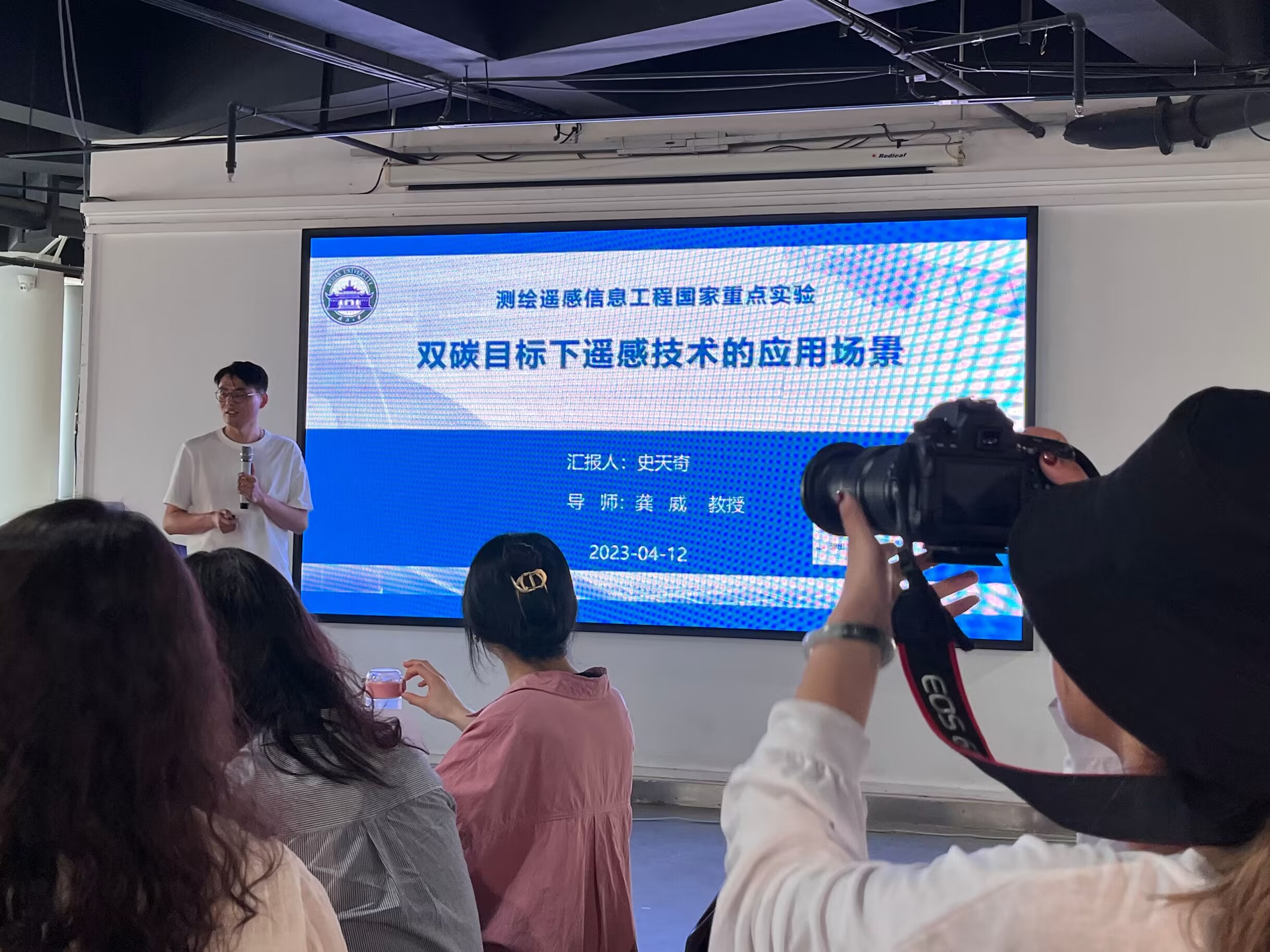
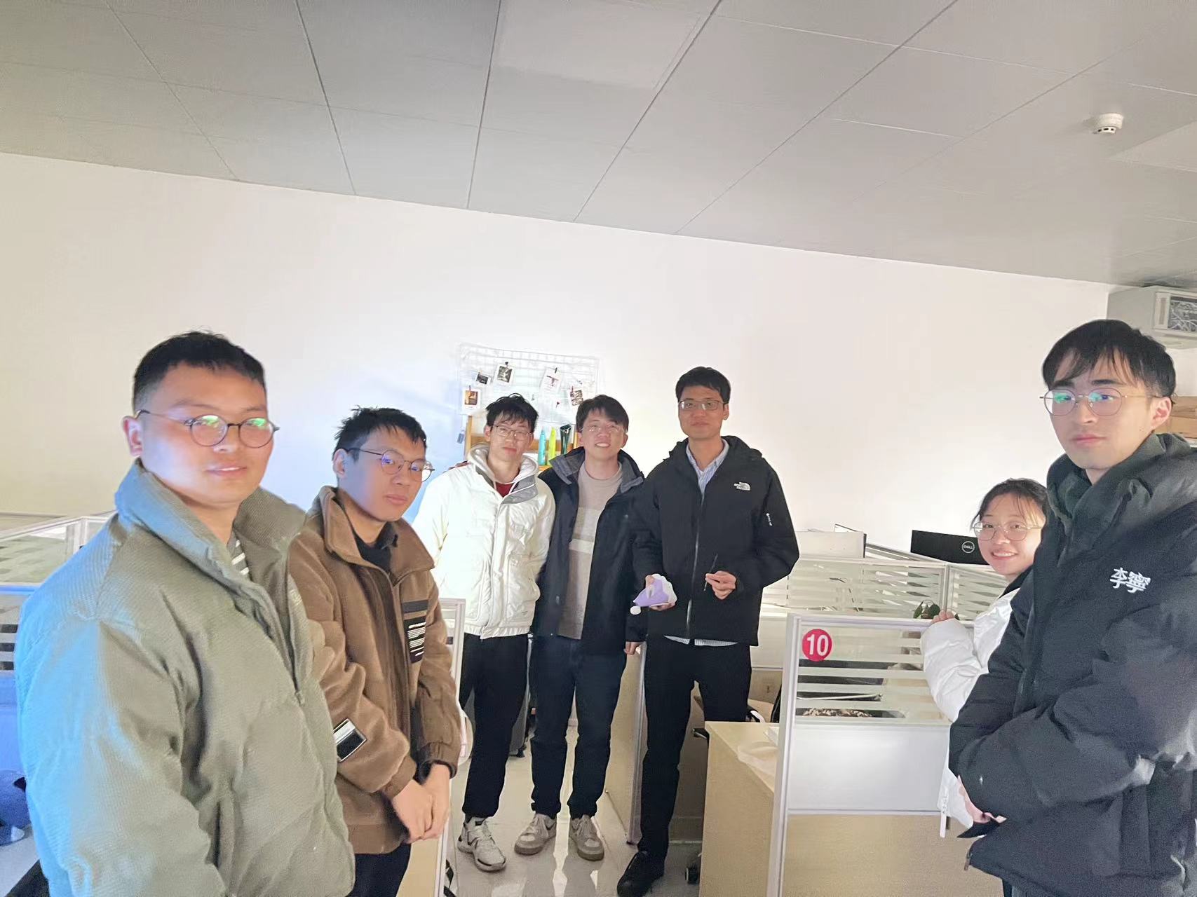
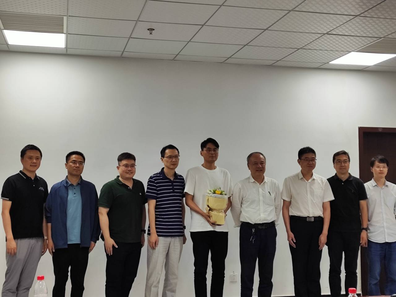
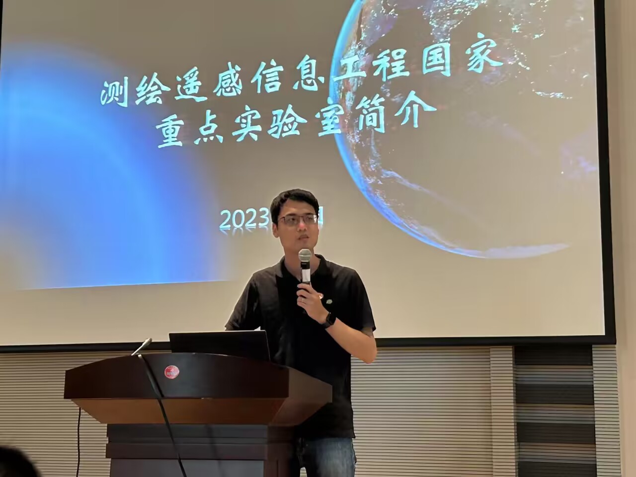


 图1 陈亮教授主持分会
 图2 参与分会人员合影(右三为陈亮教授)
 图3 焦振航博士在分会上做报告